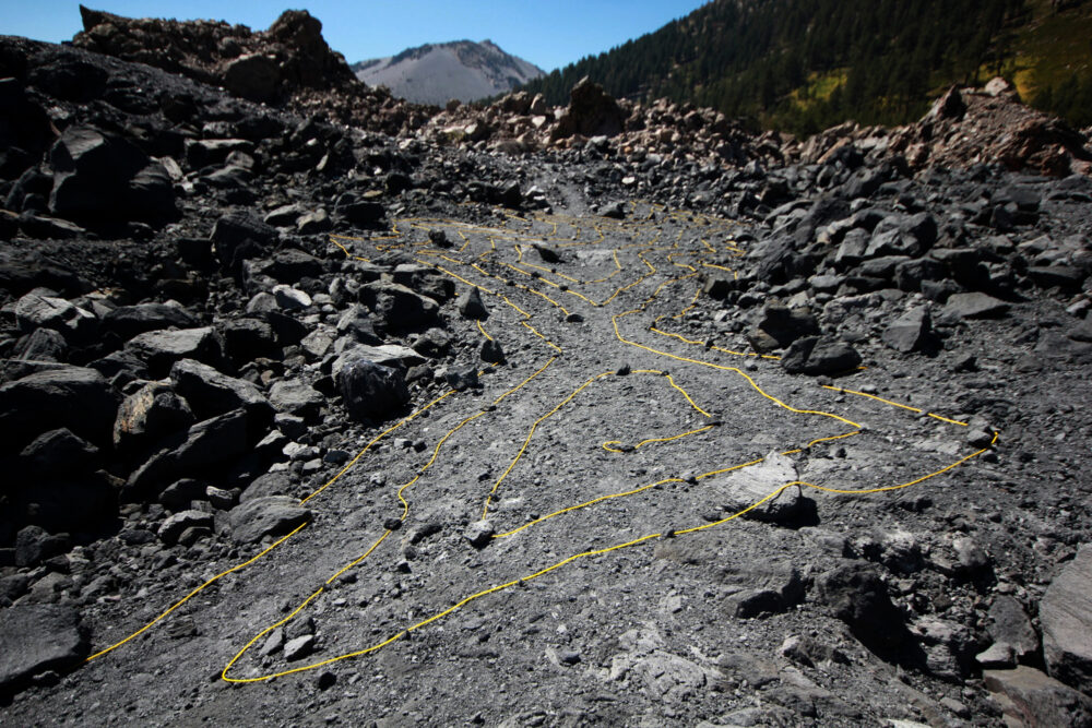
In his groundbreaking paper, “How Long is the Coast of Britain? Statistical Self-Similarity and Fractional Dimensions,” the mathematician, Benoit Mandelbrot, describes the "coastline paradox," which posits that length is an inadequate measurement for coastlines and other natural features. According to Mandelbrot, the length of a coastline is variable depending on the size of the measurement tool; the intricate roughness of natural features continuously “grows” as the unit of measurement is made more precise. Dimensions are displaced by measuring their dimensionality itself: the rate at which the feature “grows" in length and the extent to which the seemingly rough forms repeat themselves.1 Mandelbrot, Benoit B., The Fractalist: Memoir of a Scientific Maverick, 2013. This kind of geometry was eventually named fractals, a term that refers to their partial dimensionality; the number of dimensions required to describe a point, is often less than the dimensionality of space they occupy. For example, due to their (miraculously simple) scalar self-similarity, two dimensions (e.g. X and Y) can position a point within portions of three-dimensional space. Meanwhile, Cartesian frameworks, the standard within design and construction practice, are poor but necessary overseers to the elegant intricacy and paradox of natural geometries and terrain.
Yet, even with the veracity of fractal concepts well instrumentalized (in the ubiquitous and convincing video game terrain generators, for instance) and technology capable of collecting incredibly detailed distance point surveys of natural features, the obvious lament of the West's greatest surveyor, John Wesley Powell, still resonates:
The wonders of the Grand Canyon cannot be adequately represented in symbols or speech, nor by speech itself. The resources of the graphic art are taxed beyond their powers in attempting to portray its features. Language and illustration combined must fail.2 Holmes, Joseph, and John Wesley Powell, Canyons of the Colorado (San Francisco: Chronicle Books, 1996.)
Without a similarly effective link between fractal geometry and distance-based Cartesian systems, we might instead cultivate the distance between the geometric practices as a semi-discursive, sensorial dialectic; one whose failures inform the paradox. Manifest at full scale and on site, the gap between Cartesian representation and natural geo-metry is bent into a hyper and refractory terrain from which heuristics develop.